This weekend trek took us to famous impenetrable medieval fortress which is 15 km drive from our town on the road to Ellora.
We left after having light breakfast. It was my turn to drive the car and I loved it as the weather was great. Drizzling made it more enjoyable. Moreover the earth looked greener after considerable amount of rains. 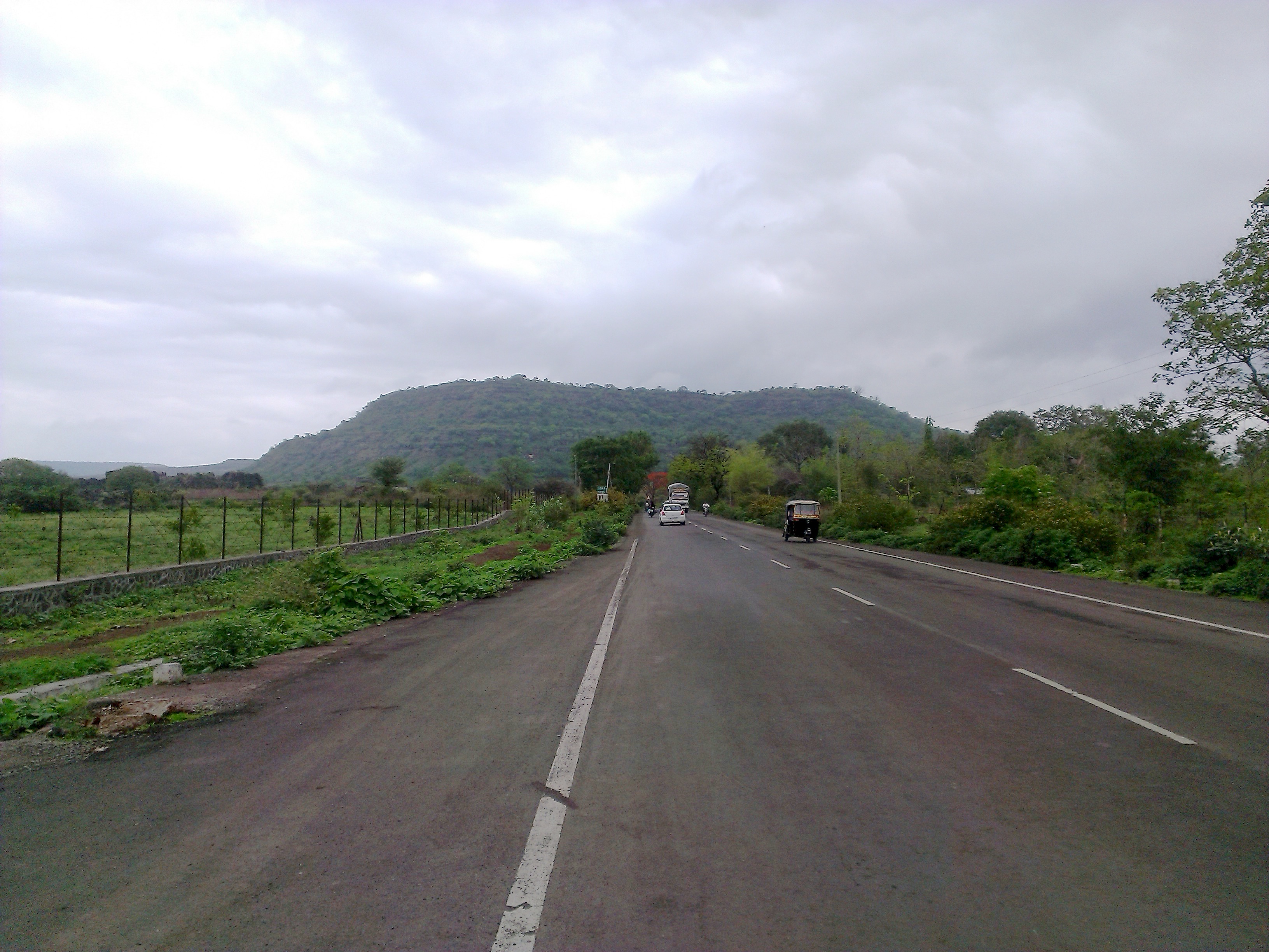
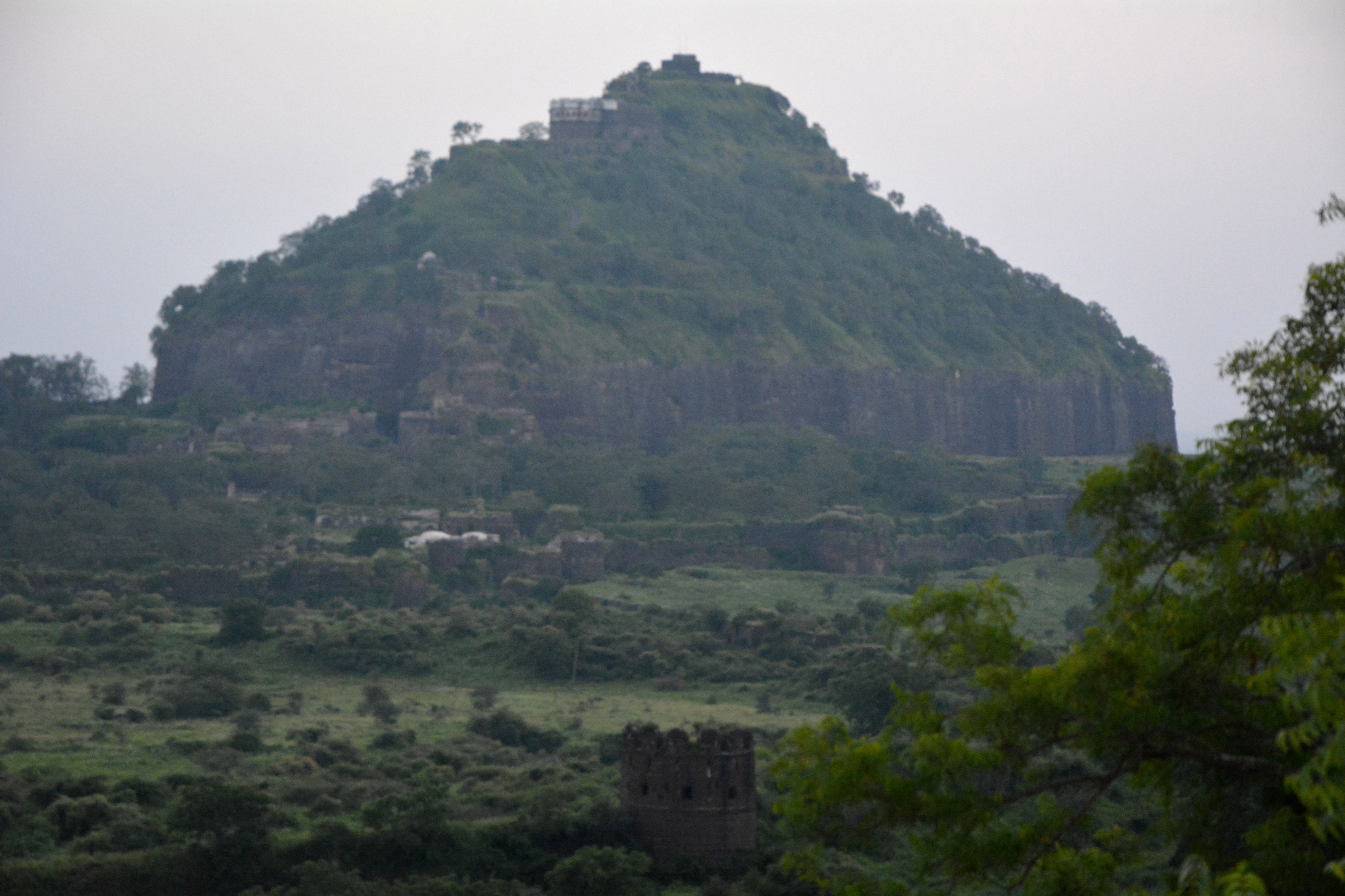
The monument is one of the most powerful forts of the medieval Deccan.It stands high on a conica hill known as ” Hills of gods” which is 200 m high. The entire fort complex consists of an area measuring approximately 94.83 hectares and represents a unique combination of Military engineering, amazing town planning with unique water management system and architectural marvels with strong religious and political hold.
The great pyramidal shape is visible from a good distance as it dominates the landscape. The picture below is of mobile phone as it was raining and I didn’t want to take out my dear camera.

It was founded by The Yadavas of Devgiri ( “Hills of Gods” ) during their kingdom in 11th century. After various attacks, the Khilji dynasty annexed Daulatabad in 12th century A.D. Devgiri became the capital of Sultan Muhammad-bin-Tuglaq who renamed Devgiri as ‘Daulatabad’ which means “Wealth of Abode” in 1328.
In further successions it also became the capital of Nizams of Ahmednagar during 1607. Currently this fort only stands as ‘Daulatabad’. Rest has been slowly merged into Aurangabad township.

After parking the car we both geared up for trekking. Weather was great and we couldn’t hold our excitement ! Being Sunday there were many tourists and local crowd who had come to peep into medieval grandeur.
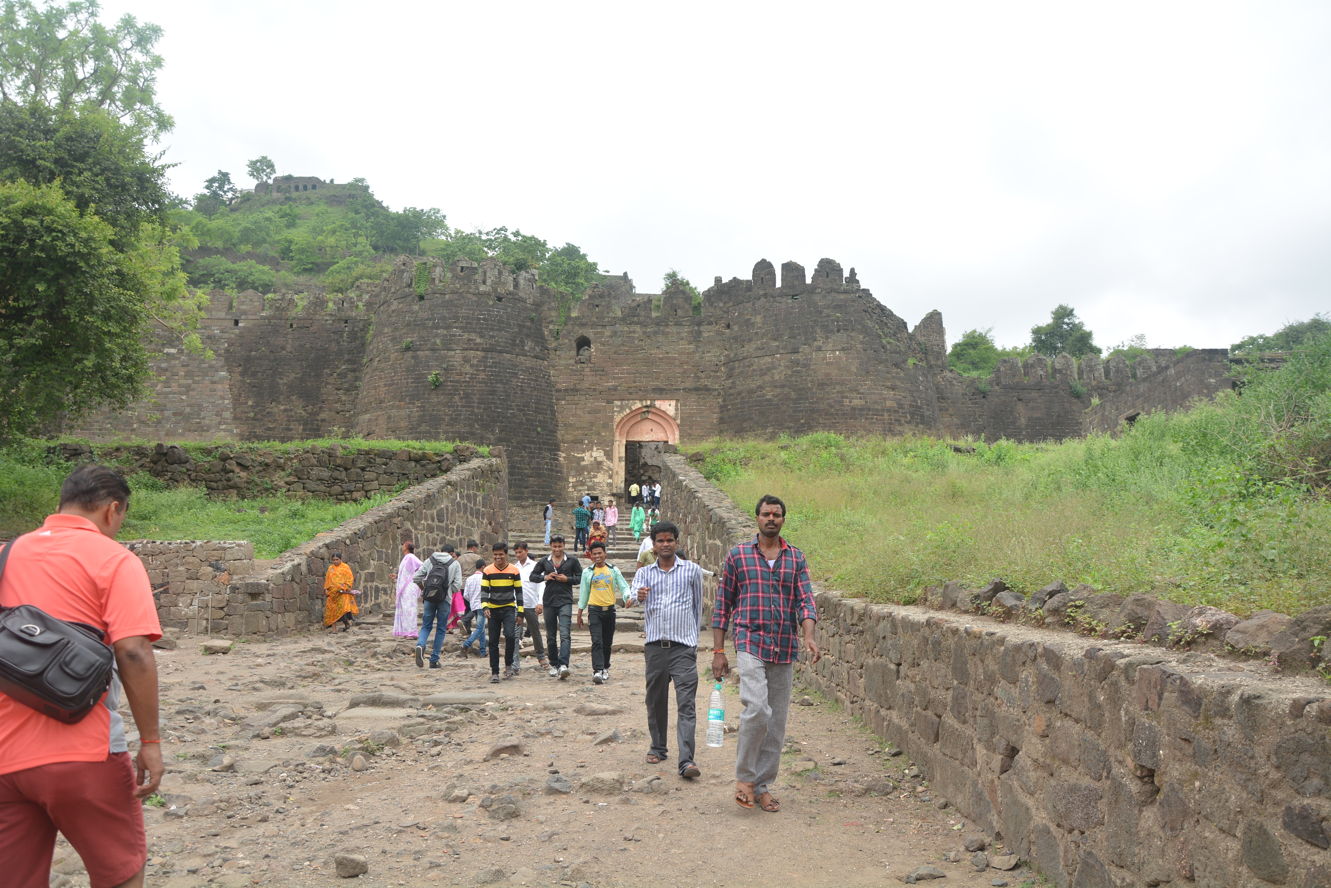
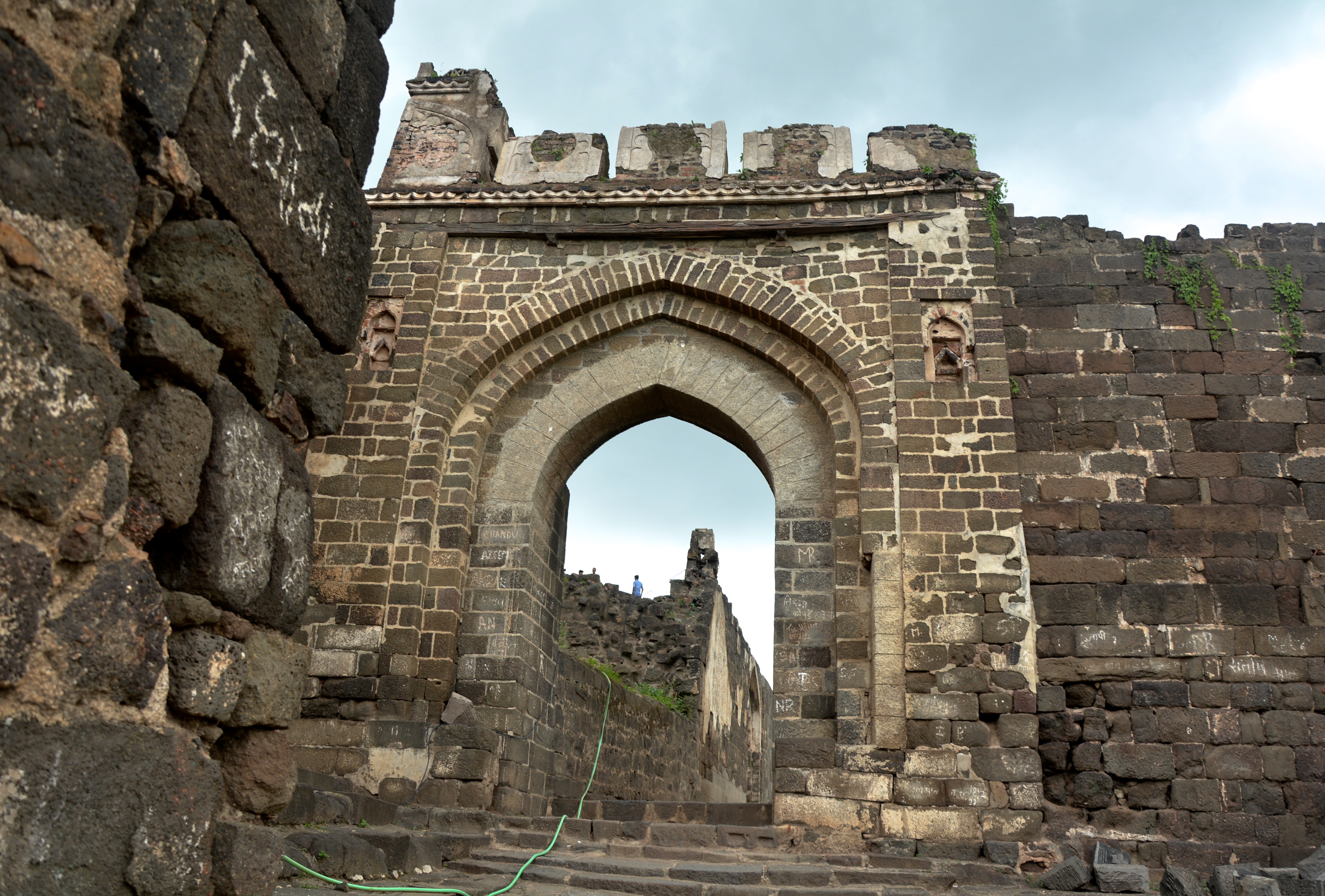
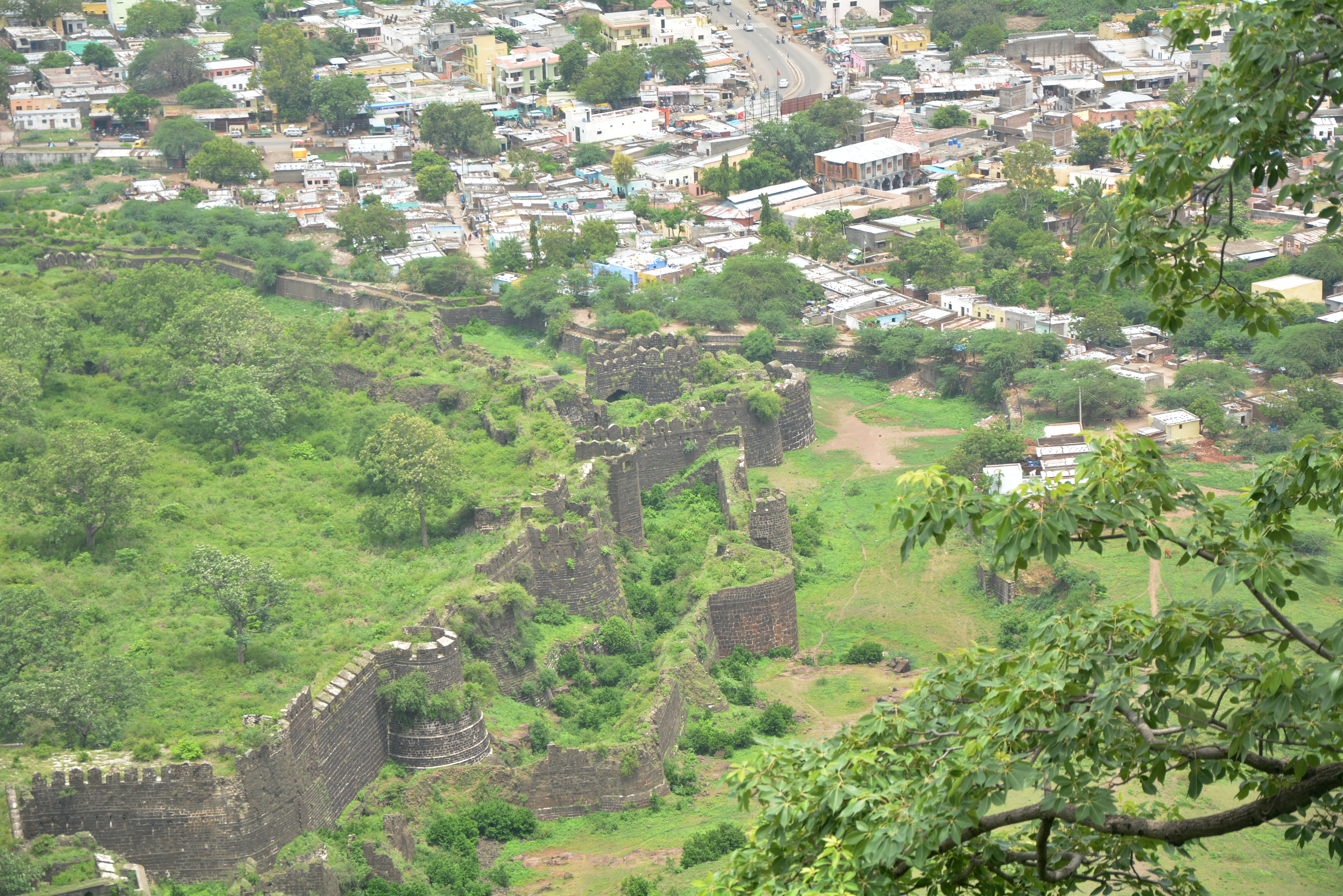
The three encircling fortification walls with wall walks, machicolations bastions at regular intervals, zigzag and lofty gates with iron spikes, gun turrets and Andheri. The combination of Hill and Land Fort, is divided into small sectors encircled by fortification walls.

Because of the strategic location and its strong protective defenses it is aptly called as an impregnable fort and its possession was craved by most powerful dynasties ruling between 12th – 17th century A.D. Its ownership became a matter of pride and prestige and haughty arrogance.
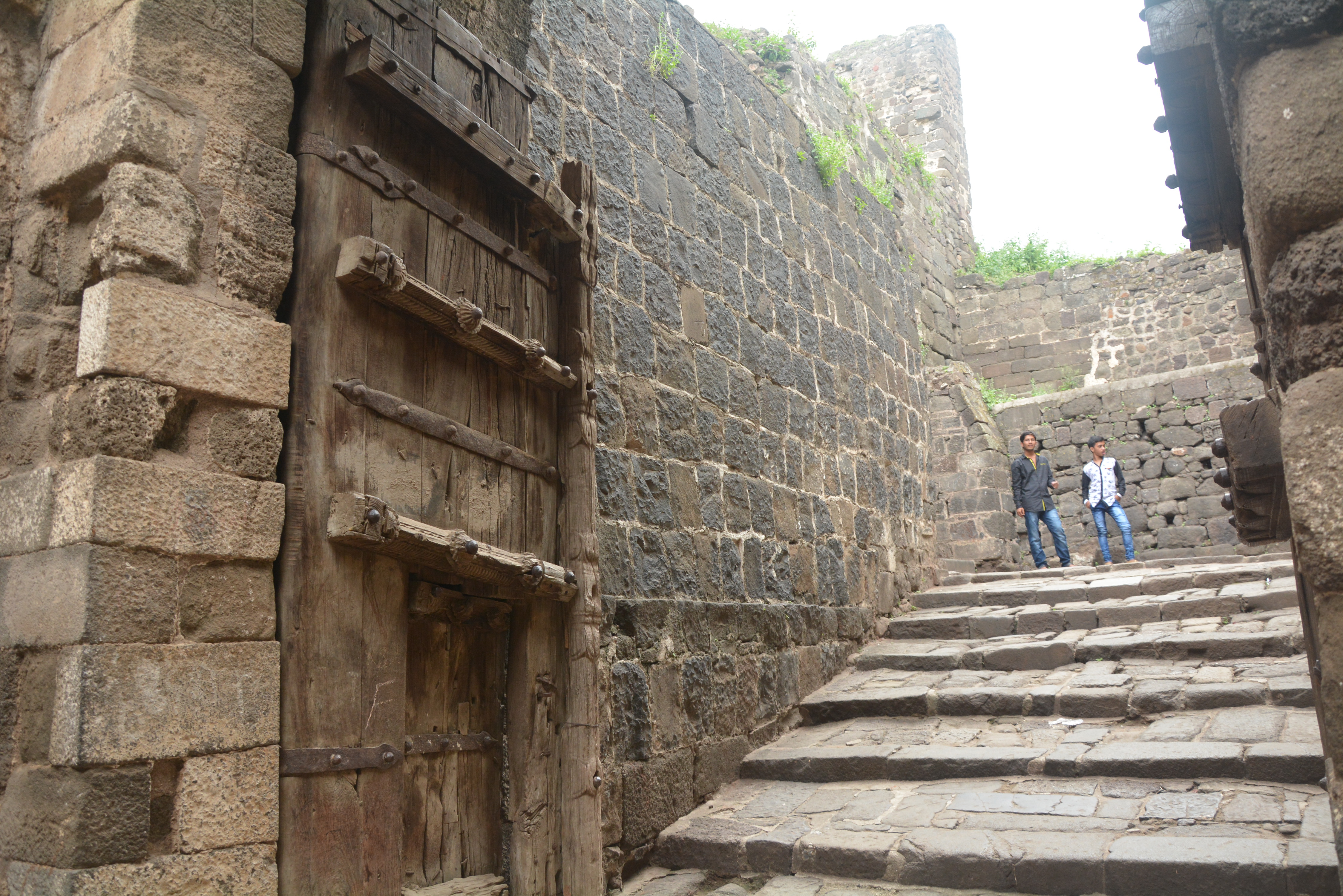
It carries a distinction of being undefeated and was not captured in battle. When we saw the solid rocky walls and the tunnel entrance along with strong defense system consists of dry and wet moats and a glacis we had to believe that.
From here the Sufism spread in Deccan.There are many significant monuments in and around the fort like temples, court chambers and Char Minar is the most famous landmark of this fort which was now right in front of us. We were about to finish our trek to see the entire landscape from the top.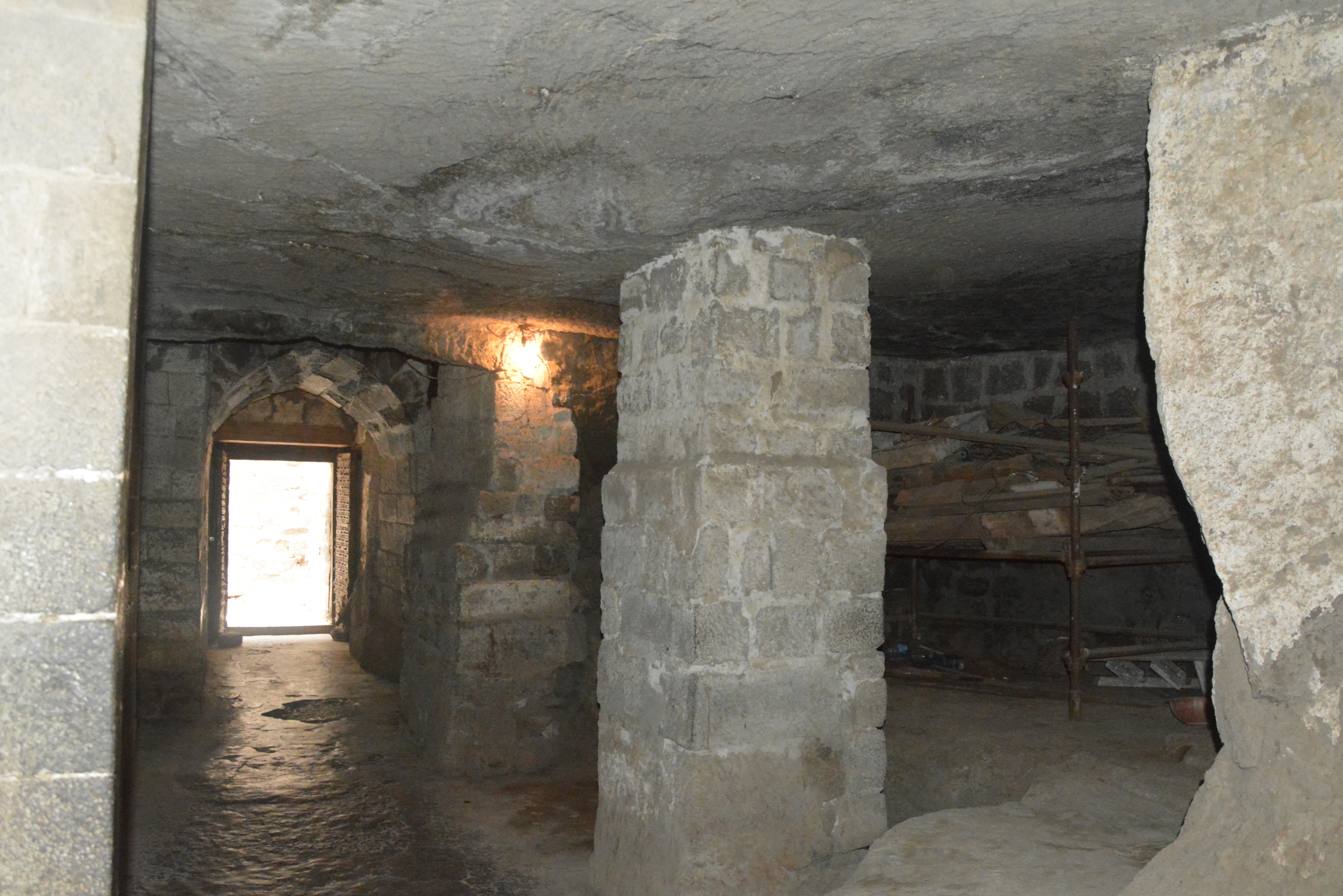
 The outer wall of the fort is 5 kms in circumference, has an average height of 6 -9 mtrs and 2-3 mtrs in thickness. The three encircled fortification protected the fort from all sides.
Finally we reached the summit and it was a delightful moment. We captured few more pics from the top.Everything was looking so fresh and green ! Monsoon is the best time to visit this place and we were fortunate to make it during ideal season.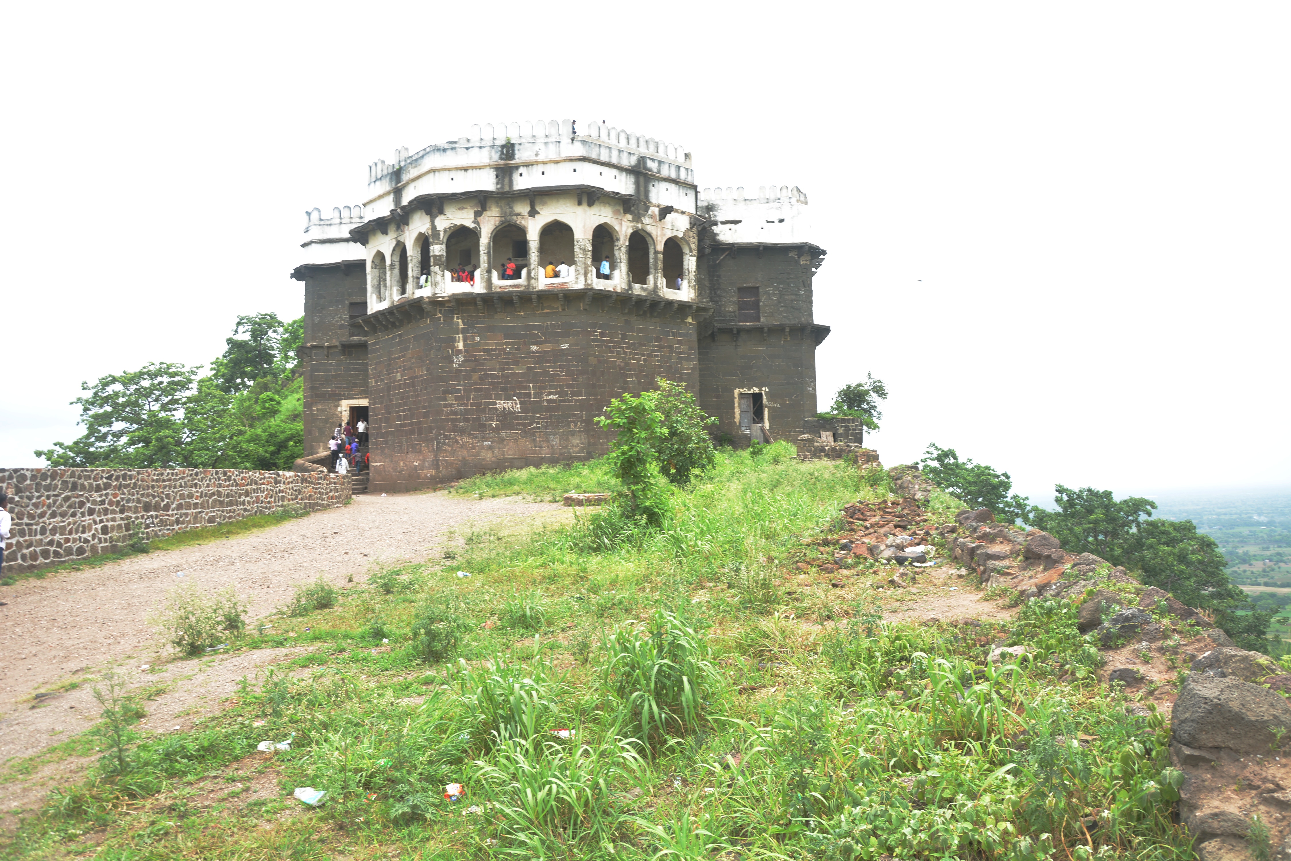

We as a couple came back with lots of good memories and hundreds of pictures. It was like a sweet dream. Will share in next post. 


11 Responses
Fascinating nature and architecture – very well captured… 🙂
Thank you Drake. I will share some pics soon.
Hi Rashmi,
Enjoyed the photos, the descriptions and even the weather with you. Lovely greenery and photos. What is glacis ?
Susie
Thank you susie. Actually the term is related to military engineering. It is an artificial slope as part of a medieval castle or in early modern fortresses. They may be constructed of earth as a temporary structure or of stone in more permanent structure.
Oh to have such places within a 15 kilometer drive, all I get to see is another village. Loved your photos and description, especially after the rains.
Thanks. This is an important landmark and can be seen from far distance. Weather here is just fine. One can enjoy driving now a days.
Wow. Impressive. I imagine that is what Masada, the desert fortress in Israel near the Dead Sea looked like before it was conquered by the Romans. There are only ruins there now. Great pictures. The walls are huge. I wonder how long it took them to build it? Does anyone maintain it today?
It was not built in one go. The successors of different dynasties kept on adding the walls and features by expanding the area. It is being maintained by Maharashtra state government and archeological department of India, but they are just doing the bare minimum. The caves were stinking otherwise the area was neat and clean. They can develop the surroundings and open some good food joints near by. Only local dhabas are there which serve okay food.
What a tremendous place ! Thanks for giving us a virtual tour of it too! Thoroughly enjoyed the hike with you and the wonderful photographs 🙂
Thanks Zee. It’s so kind of you to come along and you enjoyed the hike !
What a majestic historical place to pay the visit! These photos are awesome, Rashmi! It’s still standing tall, amazing.